AeroIntel AI: Analytical software solution for UAV operators
Challenge
Our client, a government agency in the defense sector, was struggling with the slow and labor-intensive process of analyzing large volumes of aerial reconnaissance photographs. Previously, strategic objects like aircraft, tankers, and ports had to be identified and classified manually—a process that could take several days per image set. This approach significantly delayed decision-making and introduced human error, limiting the effectiveness of time-sensitive defense operations.
The agency needed an AI solution that could automate the detection and classification of strategic objects in drone and satellite images. The system had to be accurate, fast, and capable of processing a wide range of aerial images with variations in angle, scale, and quality. Additionally, due to the sensitive nature of the data, the platform had to integrate securely with the client’s internal systems while offering scalability for growing data volumes and evolving military needs.
Solution
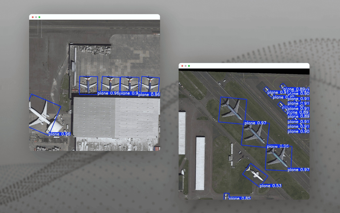
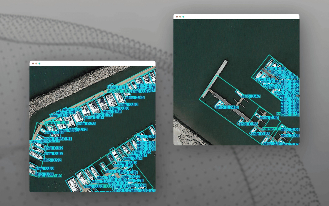
To address this challenge, WEZOM developed a high-performance AI platform for automatic object detection in aerial imagery using a customized YOLOv8 model. We applied transfer learning on top of a pre-trained YOLOv8 architecture, fine-tuning it on the DOTA dataset and a proprietary set of aerial images. The model was optimized for target classes such as aircraft, helicopters, trucks, refineries, and ports, with support for oriented bounding boxes (OBB) to detect objects photographed at angles.
The tech stack included PyTorch for the core ML components, OpenCV and NumPy for preprocessing and image normalization, and FastAPI for creating a RESTful API for inference. The pipeline processes images in batches and stores results in PostgreSQL with JSON-formatted outputs, making it easy to connect with dashboards, GIS systems, or situational control centers.
The platform architecture allows near real-time image analysis while maintaining high accuracy. It eliminates the need for manual labeling of new data, thanks to transfer learning and the future implementation of active learning mechanisms. This scalable solution provides mission-critical intelligence support and can evolve to detect new object types or integrate with GPU clusters for massive dataset processing.
Results
The AeroIntel AI platform significantly accelerated and improved the client’s aerial image analysis workflow. On a test set of 1,000 drone and satellite images containing over 200,000 labeled objects, the model achieved [email protected] = 80%, precision = 0.82, and recall = 0.80—performance metrics that meet real-world operational standards in defense. The average inference speed of 0.3 seconds per image allows the system to process data in near-real time, which is critical for dynamic decision-making.
The solution reduced manual processing time by more than 90% and minimized human error. With the ability to detect objects regardless of orientation or camera angle, the platform has proven highly reliable even under challenging imaging conditions. Moreover, its modular architecture allows for future scaling: new object classes can be added quickly, GIS integrations are already in progress, and GPU-based expansion is planned for processing massive archives of reconnaissance data.
This project not only modernized the client’s surveillance capabilities but also laid the foundation for broader applications in emergency response, border control, and infrastructure monitoring. The result is a powerful AI-driven system for strategic aerial intelligence.

